


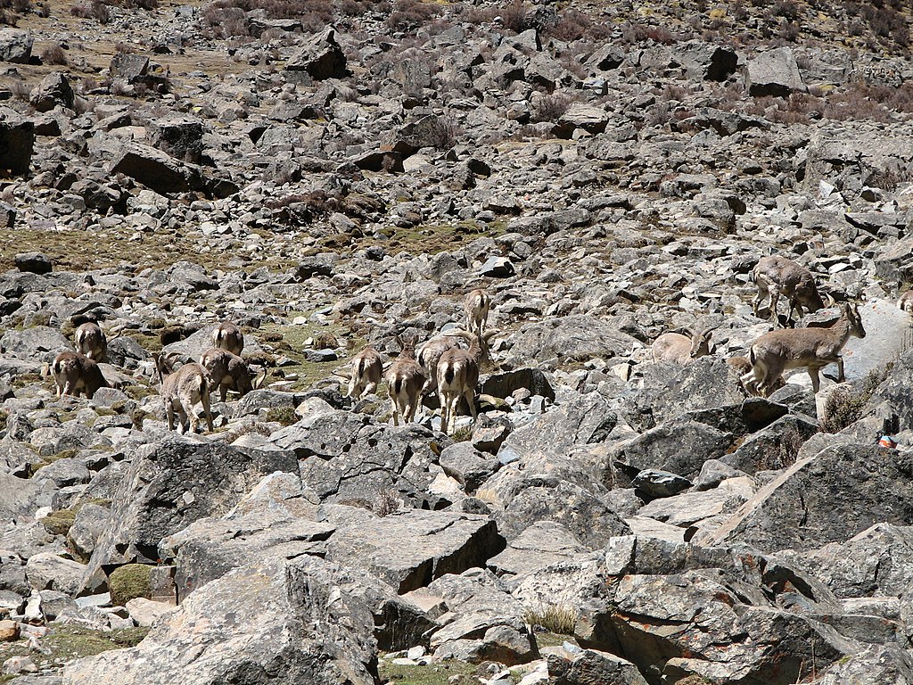
The year was 2015. Shivam Shrotriya—then a senior research fellow at the Wildlife Institute of India (WII)—and his team were in Ladakh to study the Tibetan Chiru, a majestic antelope, a ‘near threatened’ species native to the cold and dry Tibetan Plateau. Getting close to the antelopes isn’t easy not just because of their sparse populations and elusive natures, but because of their home on the plateau, right along the Indo-China border.
After a long-winded process, Shrotriya’s team received all the permissions needed from India’s Central ministries to carry out studies in this strategically important region. However, what should have been a seamless period of field work from then onwards was marred in September of that year. Tensions flared up along the Line of Actual Control (LAC) after Indian troops dismantled a Chinese shack constructed on Indian territory. Amidst the standoff, all non-military activities took a halt, including Shrotriya’s study.
“We waited around for a week hoping we would be permitted to carry out our survey, but that did not happen and we came back to Dehradun,” Shivam says, now a project scientist at WII. “While working on conservation activities or wildlife studies in conflict areas, you can never tell how the dynamics between the borders would change and impact the work [at hand].”
Between 1950 and 2000, over 90% of the world’s major armed conflicts have occurred in biodiversity hotspots, while more than 80% took place directly within hotspot areas. In the face of such geopolitical pressures, everything else in these areas takes a backseat, especially research and conservation activities.
Globally, in the context of such relations, organisations have long pushed for trans-national conservation, an approach which the International Union for Conservation of Nature (IUCN) defines as “a practical way to overcome these differences [of complex relations between countries through]…a process of cooperation to achieve conservation goals across one or more international boundaries.”
Such trans-national conservation could turn the tables in geographies that India shares with China and Pakistan, which more often than not are subjected to tenous cross-border relations. Be it the deserts of Rajasthan and Gujarat, or the Himalayan regions of Himachal Pradesh, Ladakh, and Arunachal Pradesh, these landscapes end up slipping through the cracks of conservation research.
But first, when tensions along the borders have their own political, economic, and human casualties at both ends, what does this common toll on the environment look like?
Conservation Without Collaboration
With militarised armed conflict comes strictly monitored borders, often in the form of physical fences built to restrict human movement. When barbed wires are erected however, they claim another unsuspecting victim too: wildlife.
“The Tibetan Gazelle, which is only found in the Tibetan plateau, has only one small population recorded in Ladakh. Recently, a road came up for military purposes cutting through and bifurcating the habitat of this rare species,” says Shrotriya.
Restricted movement for wildlife—which would otherwise have moved across man-made borders in the form of roads or fences—can minimise a species’ range, or the geographic area it could have otherwise spread out to. Many times, when species get split between borders, it reduces their opportunities for larger genetic exchange through reproduction. Migratory species, which need to be on the move to breed, feed, and sustain themselves, are the largest victims of these fences.
An added roadblock to conserving wildlife across borders is government permissions. Currently, conservation officers at Nepal’s Chitwan National Park, are worried that competition for resources may trigger the migration of one-horn rhinos to the neighbouring Valmiki Tiger Reserve in India’s Bihar, which shares the same forest. But, the larger cause of concern for the officers is bringing them back from Indian territory, which is a process fraught with permissions. Their experience in 2018—when floods swept three rhinos from Nepal to India—was a bitter one. When the Nepali technical team arrived at Valmiki Reserve to take the rhinos back, they were refused entry by Indian authorities on account of a lack of permissions, which seemed to have been lost in between Central ministries.
“In conflict areas, getting permission to study the environment is even more of a challenge,” Shrotriya says. “As opposed to getting permits from the state-level Principal Chief Conservator of Forests or district-level Divisional Forest Officers as is required while studying wildlife within the country, we have to approach the Centre through the Ministry of Defence for strategically important areas. These permits take time, and sometimes, by the time we get the permit, our proposed study duration is over.”
However, not all strategically important areas are conflict zones. In such areas, trans-national cooperation between countries can also benefit conservation in peaceful shared landscapes. One location where this could be successfully leveraged, for instance, is the Sunderbans, the mangrove ecosystem shared between Bangladesh and India’s West Bengal.
Lying at the intersections of the freshwater drained by the Ganga, other river systems of India and Bangladesh, and the saline waters of the Bay of Bengal, these unique mangroves support both freshwater and saline flora, making them India’s most biodiverse mangrove system. But, poorly coordinated water-regulation through dams between the two countries can tip the mangrove’s delicate ecological balance. “Over the last century, Bangladesh and India have regulated the freshwater that feeds the mangroves in both the Hooghly and Ganga rivers. While this has been done to mainly support the anthropogenic use of the rivers upstream, it has had a cascading impact on the fragile mangrove ecosystems downstream. Less freshwater and sediments would kill all those species that depend on freshwater, while the proliferation of saline water will increase,” says Sayanangshu Modak, a junior fellow at the Observer Research Foundation. While a salt concentration of 20-40% is suitable for mangrove ecosystems, both the number of species and their individual populations decline in 40-80% salinity or above. Back in the Sunderbans, a 2020 research study showed that the health of 25% of the mangroves declined because of the increasing salinity of a dominant mangrove species.
To the credit of both countries, some steps have been taken towards collaborative conservation efforts: for example, a Memorandum of Understanding (MoU) for the “Conservation of the Sundarbans” was signed between India and Bangladesh in 2011.
Finding a Middle Ground
The MoU called for “mangrove regeneration” and to “identify opportunities for livelihood generation that do not adversely affect the Sunderban [sic] ecosystem,” through shared information, joint research, and management projects between the two countries. “So far, there has been very little work in line with the MoU, apart from a joint tiger census conducted in the Sunderbans in both countries,” says Modak. “The impacts of regulating freshwater and sediments, the action of water in shaping the landscape, the increasing salinity—all these had not been addressed in the MoU, perhaps [because] it was not seen to be a threat a decade ago.”
Then, how impactful are such agreements for trans-national conservation?
If countries hold strong intentions, then conservation agreements can continue to be followed even during conflicts. Stavros Pantazopoulos, a legal and policy analyst at the United Kingdom based Conflict and Environment Observatory, explains how over a Zoom call. “The first step is to check whether the agreement provides for its [conservation’s] continuation in its text,” says Pantazopoulos. “As this is rarely the case, one could seek guidance from the Articles on the Effects of Armed Conflicts on Treaties, which were adopted in 2011 by the UN International Law Commission. This was a set of 18 non-binding articles and commentaries on what would happen to treaties when an armed conflict breaks out. The crux of the Articles was that in an armed conflict, the operation of any treaty would not be automatically suspended or terminated between the two conflicting countries. This would include any trans-national conservation treaties signed.”
Nevertheless, the fact that some agreements are “soft” law and non-binding in nature cannot be ignored—be they for conservation or otherwise. “When I was studying various agreements for 32 transboundary protected areas across the world, I found that these agreements almost never mentioned what would happen when conflict occurs or when one country ceases to cooperate and there is a lapse in cooperation,” says Elaine (Lan Yin) Hsiao, a Global Challenges Fellow at the Sheffield Institute for International Development and Co-Chair of the IUCN CEESP Theme on Environment and Peace.
So, if conservation agreements do not always work during cross-border conflicts, what will?
Towards Collaborative Conservation
For any trans-national conservation effort, data sharing is usually the first step. And in many cases, there have been successful cross-border data sharing and research interventions. ICIMOD is an inter-governmental organisation based in Nepal that works across the Hindukush Himalayas and the countries where these mountains extend—that is, Afghanistan, Bangladesh, Bhutan, China, India, Nepal, Myanmar, and Pakistan. They share knowledge and research across these regions, enhance livelihoods, and work towards sustaining resources across the countries in the process.
Just 10 of over 54k glaciers in HKH have decadal field-based mass balance measurement data. #HKHAssessement recommends improving cryosphere monitoring ➡️ https://t.co/u0gwQ3pjJK
📽️Installing equipment on #RikhaSambaGlacier for mass balance data collection.#CryosphereWednesday pic.twitter.com/hohySDIvSd
— ICIMOD (@icimod) July 22, 2020
Another such global alliance is the Global Snow Leopard and Ecosystem Protection Program. Supported by the Global Environment Facility and the United Nations Development Program, it brought countries together to protect 20 snow leopard habitats by 2020—including the likes of Afghanistan, Bhutan, China, India, Kazakhstan, Kyrgyz Republic, Mongolia, Nepal, Pakistan, Russian Federation, Tajikistan, and Uzbekistan.
An alternative for ensuring documentation despite ongoing conflicts has been using citizen science. This helps fill gaps in data collected, especially since international conflicts can last over several years, resulting in significant delays in assessment. “Observations from people in the ground immersed in a particular context can provide vital missing clues to any investigation, especially in post-conflict situations where access for professionals is limited,” scientists suggest in a 2019 paper.
Shrotriya suggests going a step further than just sharing data across borders. “Instead of trying to perform conservation in these conflict areas, conservation can be [also] used as a means to reduce conflicts,” he says. His suggestion resonates well with a recent article by Indian conservationists that calls for warring countries to declare certain species that they have in common with their adversaries as ‘flagship species’. Examples of the same could include the snow leopard, the Kashmir markhor, the bar-headed goose, the great Indian bustard, and the Indian wild ass, all of which are found in India and in neighbouring Pakistan and China as well. “They [the flagship species] can potentially break the ice between neighbouring countries, which might bring a paradigm of not just trans-boundary management, but also a conversation along the lines of economic, social, and political peace,” the authors write.
In Africa, this approach was also adopted by the Democratic Republic of the Congo, Rwanda, and Uganda to conserve an endangered species—the mountain gorilla. “Since this was a high profile and high value species that lived across conflict afflicted borders, it became important for the countries and conservation actors involved to coordinate efforts between the states. It became a strategy towards species protection until there was peace again for the countries,” Hsiao comments. Such programs and projects between the three countries have continued despite various forms of internal and cross-border civil unrest between them.
Whether it is data sharing or other collaborative activities, Modak believes that the root of it all is intent. “The countries must have the intent to have common conservation goals. For countries to build that intent, we [at ORF] try to document what the costs of inaction by both countries will be. There is robust science to show the impacts of the degradation of the Sunderbans if both countries choose not to act, and that the accountability for [addressing] this lies with them.”
While the costs of armed conflicts are many, the focus on their environmental costs usually take a back seat. Sometimes, this can also lead to bizarre results. “Recently, an Indian research paper of a study in Ladakh was declined by a reputed Chinese scientific publication during the final stage of its review,” shares Shrotriya. “The email by the editors stated, ‘the map of the study may raise some political issues’. Upon requesting further clarification, the editors responded, saying ‘It is not the matter of the map but the matter of the study area’.” This is just another nail in what might soon be a coffin for conservation and research activities in conflict regions. That is unless, of course, trans-national conservation can help lead countries and their flora and fauna towards a brighter future.
Featured image: Pangong Tso lake in Ladakh hosts migratory birds from Siberia; the lake is also located in a highly sensitive location, and is the site for a current military standoff between the Indian and Chinese armies. | Courtesy of Tushar Kulkarni (CC BY-SA 4.0).


[…] Environment, the Unsuspecting Victim of Cross-Border Conflicts - The Bastion […]